Saturday, September 24, 2016

Cripple Creek to Ouray Colorado

Saturday September 24, 2016

We woke up at 7:00.  It had been a cold night.  The temperature outside at 7 AM was 25 and inside the Sprinter it was 39.  The one thing we had forgotten was the space heater!  We truly did not expect quite this cool temperatures – I had checked the temps each place and 40’s maybe but not 20’s!  We were not too uncomfortable in our sleeping bags with long sleeve shirts but it was too cold for cooking etc….we broke camp in 15 minutes and were on our way back down the mountain to Florissent where we had hopes for finding coffee and some breakfast.  And did we ever find a good breakfast!  Costello Street Coffee House!  We split biscuits with sausage gravy, a cinnamon roll, and a blue berry scone – they and the coffee were great – not sure if it was us being so hungry or the food….I think it was both.  Restaurant was an old farm house – most of the downstairs rooms were furnished with antiques – the one we were in had an entire wall of tea pots on beautiful shelves.  And the tables and chairs were all old as well…you ordered at a counter where they displayed all their fantastic baked goods and then they brought out your food.  Great second start for the day.
Cinnamon Roll

Biscuit with Sausage Gravy

All the goodies we did not eat!
We headed west on US 24 to Buena Vista and then US 50 through quite a number of small towns on our way to Gunnison.  We crossed what I describe as high plains – lots of cattle, baled hay, and farms.  We saw quite a number of antelope.  Always ahead were the Rockies and there was snow.  The aspen in the snow was certainly beautiful.  We crossed Monarch Pass at 11,312 feet. The road was clear but the parking lot where we stopped to take a photo was still icy.  The scenery continued to be outstanding as we continued to Gunnison. 

Mountains to the West
We began to see snow!

And more snow on the peaks

At Monarch Pass - 11,312 - Continental Divide


In Gunnison we made a Walmart stop – for all the things we needed – a small heater, WD40 for a squeaking door, Windex since we have used ours up cleaning off bugs, and some eggs.  If you continued north from Gunnison you would reach the well-known ski resort – Crested Butte.  We headed south since we need to be in Durango on Sunday to meet Ben’s college roommate.  From Gunnison we headed west to Black Canyon of the Gunnison National Park.  We traveled along the Blue Mesa Lake that had been formed by a dam on the Gunnison River.  It was a huge lake at 7,000 to 8,000 feet elevation. However with the overcast sky and low temps today few people were out enjoying the water!

Blue Mesa Lake
When we reached the park we viewed their film, got a passport stamp, got Daniel a post card, and spent some time at a couple overlooks looking down into the gorge.  This river carved a very deep canyon in the rock – about 2,000 feet– the canyon remained unexplored until well into the 1900’s. 

Black Canyon of the Gunnison

Black Canyon of the Gunnison

The patterns in the walls of stone were facinating
A few miles west of Black Canyons of the Gunnison is Montrose.  Montrose was probably the largest town we visited today. We joined US 550 south to Ridgeway and then Ouray.  Ouray is known as the Switzerland of the US and it is indeed again in the Rocky Mountains at 7,792 ft elevation!  We had planned to stop at the KOA and it is on the north of town. 


approaching Ouray - it is really gray and gloomy!

Ben with his TV set up watching something - with heat!
We had had a wonderful day even with a bit of a rocky start!  Glad though to be stopped where we could climb in the Sprinter, set up the TV, plug in the new heater, and cook supper.  If you have read our blog before you know our Sprinter Van allows us space for about anything – but only one thing at a time. You can lounge, cook and eat or you can sleep – comfortably but not at the same time.  Our late afternoon - evening was of the lounging and eating mode. A first for us – Jane baked corn muffins to accompany our canned beef stew.  It surely did taste good!  Maybe that was because with our huge breakfast all we wanted for lunch was cheese crackers! 

Caught up on the blog even though the internet connection did not allow for posting photos.  The weather forecast maybe calls for snow – if so our departure may be delayed a few hours tomorrow as we must cross three 10 - 11,000 foot passes. They say if it rains here in Ouray, it will snow in the high passes.  The road from here to Durago is known as the Million Dollar Highway – both for the views and the cost of building it!  It closes for ice… so we may not be leaving here until noon or so…..time will tell.

Cripple Creek Colorado

Friday September 23, 2016
Cripple Creek Colorado

Good Connection now but lighting is terrible- hope I have picked the right photos!

Today we deemed an explore and rest day.  I cooked a fairly decent breakfast of toasted English muffins, grits, and bacon and of course coffee!  Feeling some better after a great night’s sleep.  We reviewed our options for exploring and decided to visit the Heritage Museum to learn about the history of the mining and railroads and then drive the Gold Mine Loop to Victor and back to Cripple Creek.  It was beautiful clear blue and the aspen were breathtaking.  There was a Festival being planned for the weekend so the entire downtown area was blocked off.  Downtown Cripple Creek is a restored theater, lots of shops, a few restaurants and LOTS of casinos. 

Looking down to Cripple Creek

Aspen View


The Heritage museum was on the far side of town from our RV Park and when we arrived the view was almost beyond description.  To the west were rocky mountain peaks as far as you could see north to south.  To the east were remains of old gold mines and the terraced land from the current day mining operations.  The mining operations in the late 1800’s and early 1900’s put the Pikes Peak area on the map. Many a man made his fortune here and many more lost.  The mining continued for many years and gradually slowed until in the 1990’s the remaining gold mines were consolidated and today surface mining under the Cripple Creek and Victor Mining Company. This is a part of a large company- Newmont- that as an aside we own stock in!  They have very stringent regulations and from the looks of things are returning the land to as close to what was there before as possible.  The ore is surface mined, trucked out, crushed, and processed to recover the gold. Ben remembers the recovery rate of 360 ounces of gold per ton of ore.
Old Gold Mine

Working Cripple Creek and Victor Surface Gold Mining Operation


We viewed the old and new mines.  Tours of the surface mining site closed on Labor Day – it would have been very interesting.  Having been underground in a Copper Mine in AZ we opted out of going down in one of the old Gold Mines.  The drive through the mountains to Victor and then back to Cripple Creek was beautiful
View to the West

Aspens

Ben beside tire from one of the Ore hauling trucks

We returned to camp, had lunch, read, did some internet surfing, wrote and posted the blog, cooked supper, watched a movie – in other words did quite a bit but not a lot of anything!   Jane felt some better today but not 100%.  I think I mentioned yesterday our RV park - Hospitality House - was behind a Bed and Breakfast that is the restored Teller County Hospital.  Got a photo today. 

Hospitality House B & B - Old Teller Co. Hospital

Friday, September 23, 2016

Colby Kansas to Cripple Creek Colorado

Thursday September 22, 2016

We left the Quality Inn in Colby in a dense fog.  We bought gas and headed west on I 70 with only about 80 miles left until we reached the Colorado border. Flat land and we assume it looked similar to yesterday – every once in a while I would catch a glimpse of the base of a wind turbine. As we neared the border we checked the altitude – we were at about 3,500 hundred feet so we had been climbing consistently since Colby which was around 2,500.  The highest peak in Kansas was Mount Sunflower (appropriate name) at 4,039 about 20 miles to our south – we could not see it of course. 


The fog began lifting a little as we stopped at the Colorado Welcome Center about 20 miles into the state. The terrain still remained flat with a few rolling hills as we continued to Limon where we would leave I 70 and head south to Colorado Springs. As we continued west the fog gradually lifted. After leaving Limon on US 24 we began to have some great views off to the west – Pikes Peak!  Ben remembers reading the pioneers would travel 2-3 days to reach the mountains after they first saw them from the plains.  I remember distinctly the view from a high point in Denver when attending a conference there some years ago before I had ever traveled in the west – the stark difference in looking east to the flat plains and to the west to the Rockies…. It is quite the dramatic change in terrain and in altitude.  Beautiful today with clear blue skies! 


Our plans were fairly fluid – we had some things we wanted to do in the Colorado Mountains and most of them were not in Colorado Springs.  Ben had spent 2 days here several years ago with his scout troup on their way to Philmont Scout Camp.  Their reason for staying the two days in Colorado Springs was to acclimate to the higher elevation before continuing on to Philmont and a hiking adventure.  We wisely or unwisely said – “Let’s just continue on into the mountains as we did not think the “red rocks” here were going to compare at all to the ones we would see in a few days in Utah.  We wanted to see the Colorado mountains and the Aspen trees which we had hoped would be in their glory…the folks at the visitor center confirmed for us they had begun turning about 10 days ago…...so off we went on through Colorado Springs on US 24 headed to Cripple Creek.  We skirted around Pike’s Peak and continued through the touristy Manitou Springs, Woodland Park, and Divide.  The aspen, green fir, and mountain rocks were outstanding. 


At Divide we headed to Florissant Fossil Beds National Monument. This was a quite unique national treasure.  In the formative ages of this earth – this valley had been a lush redwood forest and valley.  It was covered by a volcanic eruption that buried the huge redwoods up about 15 feet.  And all the insects, animals, and plants were fossilized.  Today this area has some of the best preserved fossils and petrified wood to be found in the world.  We ate a late lunch here and watched a very good film.  We also took a couple very short hikes. 


I was really beginning to feel strange – woosy and short of breath.  The altitude was getting to me – we were at nearly 9,000 feet and had been at 2,500 this morning. I immediately began drinking lots of water – but still did not feel great.  We continued on about 20 miles to Cripple Creek.  The scenery was fantastic.  High mountains with the Aspen and Evergreens with meadows turned a golden color with fall.  There were many small farms and homes throughout the area.  We passed 2 lama ranches and many with cattle, horses, and goats.


We rounded a curve at about 9,500 feet and we arrived at Cripple Creek – an interesting gold mining town that continues to mine gold but has also one of several towns in Colorado to legalize gambling.  We arrived about 3 and drove directly to the RV site we had selected.  Hospitality House and RV Park is a high end Bed and Breakfast with RV park behind it.  The building was the Teller County Hospiital built in early 1900’s and restored some years ago as a quite unique Bed and Breakfast. The setting is beautiful with high mountain fields behind us. The town and exploring would wait for tomorrow.  We checked in for 2 nights and continued to drink water and do nothing for several hours.  By suppertime I was up to getting my “kitchen” organized, prepared brownie muffins in the toaster oven (a first and pretty tasty) and warmed the remaining half of our country fried steak dinner from Colby for our dinner.  The activity was all I had in me for the evening – we read books and watched a movie. 

Poor Photos for today - best I can manage - am better but still not 100%  but wow do we have some great views for tomorrow!    The internet connection here is very slow hope for better tomorrow or the next day to catch up! 


Wednesday, September 21, 2016

Kansas City Kansas to Colby Kansas


Up and on the road by 8:30.  We thought we would have to back track through part of Kansas City to return to I 70 but we were directed by trusty GPS on a bypass and there was very light traffic.  When we joined I 70 it was the Kansas Turnpike for about 50 miles. 
Toll booth as we entered the Kansas Turnpike

Nice road that continued on to the southern border of Kansas but we left it going to Topeka and points west.  We were headed to Colby about 50 miles from the Colorado border with a stop in Abilene to visit the Eisenhower Presidential Library, Museum, and childhood home. 

Kansas is very rural for the most part – lots of agriculture – corn, wheat (that had already been harvested), soybeans, millet, and sunflowers!  Also lots of cattle.  I was not expecting the oil wells but there were many and also hundreds of wind turbines.  Also lots of history with museums in nearly every town telling about the pioneers and the homesteading that took place in the 1800’s. 

We were interested in the grasslands – an area called the Flint Hills – was in the more hilly eastern part of the state where the soil was not very deep – most crops would not grow so the grassland survived.

Highway cut in the Flint Hills - rock with very little soil

Tall Grass covered much of the land

Poor photo of sunflowers

Millet used for cattle feed

Eisenhower is the first president we really remember and with Ben’s interest in WW2 we enjoyed our short stop at the Eisenhower Presidential Museum.  We have visited several others and this one was well done.  I will let a few photos I took tell you a bit about what was there.  We had lunch under some trees before we left the complex.  We were there about 2 hours and perhaps saw 1/3 of what was there.  We did not see the graves or enter the library.  Ben says his favorite thing in the entire museum was an enigma machine - this was the machine used by the German's during WW2. The Allies captured one and were able to use it to decode messages throughout the war - ( Bentchley Park show on TV). 

Home where all 6 Eisenhower sons grew up - their mother lived here until 1946

Chapel where Ike, Mamie and other family members are buried

Some of Mamie's jewelry

Statue of WW2 soldier at Battle of Bulge.  There were many others throughout the museum

Huge collection of "I like Ike" items

Huge collection of Ike's military honors and awards

Poodle Skirts - every female had one - I did!

Ben cleaning off bugs after we enjoyed our picnic lunch

Abilene KS is still a small town.  This is and was the main street.  The Eisenhower home was on the "wrong" side of these tracks but every one of the sons was successful in his chosen field. 

We still had 200 miles to make it to Colby!  Today the temperature was still in the 90’s but since it was overcast did not seem as hot.  We kept expecting rain but it never came.  Ben was fighting a wind from the southwest all the way from Abilene to Colby.
a few of the numerous wind turbines

one of many grain elevators

In Colby we stayed at a Quality Inn and had country fried steak (a Midwestern classic) at a local restaurant.  (forgot to take photos but country fried steak looks like you think it does)  Good!   Tomorrow we will move into our camping mode. 

Tuesday, September 20, 2016

Paducah KY to Kansas City KS

Great nights sleep!  A good hotel breakfast, buying gas before passing into MO and we were on the road again!

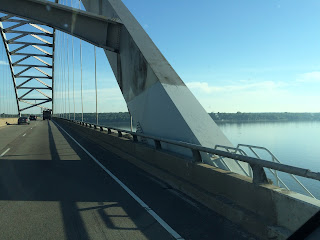
Today was going to be 100% interstate driving.  Yesterday we drove 450 miles - about our max for comfortable driving.  Today was going to be about 400.  We are anxious to get to the good part of our trip!  The weather was clear and sunny.  We crossed the Ohio River and headed out on I24 then at Vincennes I57 and then I64, finally just to the west of St. Louis we joined I70.  We crossed the great Mississippi in St. Louis and viewed the arch.  Having been there several times we kept on truckin’ – at 11 AM the traffic through the city was not bad.

Missouri River

Today was field upon field of corn, soy beans, and nice looking farms here and there.  The corn crop seems to be great this year.  Much harvesting was in progress and it was interesting to see the huge machines blowing the bright yellow corn into the collection vehicles.  Can you tell this city gal is not too good at the names of the various farm machinery!  I certainly appreciate the hard work of these American farmers -  today was not cool as we expected.  Temperature was in the 90’s !

Typical Farm with Jerusalem Artichoke in foreground

We have been enjoying ragweed and various purple asters along the roadside. Today the wildflower dominating the roadways was Jerusalem Artichoke - a high yellow daisy type flower. I took a closeup of the Jerusalem Artichoke this afternoon at a rest stop. 
Jerusalem Artichoke

St. Louis Arch as we cross the Mississippi


We are listening to a Patterson mystery today to help pass the time.  Lunch was at a rest stop along  I70 – that was when we discovered how hot it was - 94.

We arrived in Kansas City and stopped to buy gas in MO for $2.08 before heading into the city and Kansas.  It was 3:30 and there was LOTS of traffic.  The two largest cities of our trip and Ben made it through both today with great skill.  GPS is truly a modern marvel for getting around in cities.  I still love following maps but finding the best way to a specific motel is not my idea of fun.

After a short rest we headed out to find our Kansas City BBQ.  After scoping out the 3-4 best BBQ restaurants on Trip Advisor I hope one will be near where Ben makes hotel reservations.  This time it worked out – 3 miles to Woodyard BBQ.   The owner has had a wood yard selling wood to most of the BBQ spots in the area.  A few years ago he added a small BBQ stand that has grown into a full restaurant. 

Potato Salad, Burnt Ends and Ribs

"Carolina Pulled Pork" and beans

Sprinter parked at WoodYard BBQ

Well Kansas City BBQ is not TN BBQ or NC BBQ or even TX BBQ but I take everyones' word that it is good.  We liked the ribs very much, the burnt ends were OK, but the Carolina BBQ sandwich did not measure up at all!  The meats had a very smoky flavor.  The sauce was too “tomatoey” for us.   Ben thought it needed more vinegar and I thought it should have been a bit sweet….  All in all we succeeded in finding out about another type of BBQ. 


They still sell lots of types of wood


Now to watch the first NCIS of the season and get to sleep early – tomorrow we cross most of Kansas. Colorado here we come!

Monday, September 19, 2016

Western Adventure - Indian Country IX

Monday September 19, 2016
This trip will be about 4 weeks long as we head to the mountains and buttes of Colorado, Utah, Arizona and New Mexico.  We hope to see Aspens in their golden glory, enjoy the red rock area, and explore some Indian territory. It is hard to believe this is our 9th trip to this area - we love it!

 We zipped through our early morning checklist and pulled out of the driveway at 8:00 AM.  It was cloudy and rainy – we had the first rain storm in over a month last night.  Fog hung in the valleys as we headed west towards Rogersville.  The sun began peaking out of the clouds as we continued down 11W and turned north up 25 towards Cumberland Gap.  Crossing Clinch Mountain we were back in the fog so no great views of the lakes and mountains to the south today.

11 W to Rogersville


Clinch Mountain

Interesting as we approached the tunnel through the mountain at Cumberland Gap – huge STOP TUNNEL CLOSED sign.  Never seen that before.  Traffic came through from north and then was stopped. A pilot car took two haz-mat tankers through and then when they had passed out on the north  - traffic was again free to go in both directions.  So when they have a haz-mat load passing they stop all the other traffic.  Great safety feature.

Cumberland Gap Tunnel


Little traffic today, we continued on to Corbin where we stopped in a truck stop and drove out white instead of gray!  Our trip is to Colorado Springs – hopefully in 3 ½ days.  We had divided the drive by mileage and our first day destination was Paducah KY.  We thought this was new territory for us – turns out for Ben it was a journey back in time.   At London KY we turned west and would drive 300 miles across the state of KY to Paducah.  We had about 20 miles of 3 lane road until we hit the Cumberland Parkway in Somerset where we had a low traffic 4 lane limited access highway that would take us to Bowling Green.  The terrain was rolling hills and low mountains – very remote but excellent road.  One thing missing on this road were rest stops.


In Glasgow KY we left the road and drove into the town.  It was larger than we expected but places to stop to eat lunch did not materialize.  We pulled into a nice shady parking spot on the courthouse square and we enjoyed our picnic lunch.  Interesting signs – for a small town in rural KY – seems they were ahead of their time!


Between Glasgow and Bowling Green was the road north about 20 miles to Mammoth Cave National Park – for another time. 

Continuing west past Bowling Green we took the William Natcher Parkway north to meet the Western Kentucky Parkway.  This Kentucky road system is impressive. Most of these limited access highways said Future ## Interstate – but it will be many years before they turn them into a part of that system.  As we turned west again there was a Rest Area – Visitor Center.  Seems this is Muhlenburg County – we are back in Coal Country!  Ben got a “Friends of Coal” sticker that he had been wanting!  We also discovered we were near Central City where he stayed off and on for several months back in the 70’s when his company was working on the Paradise Nuclear Plant.  That brought back lots of tales of his activities then.   The rivers all through KY are also vital landmarks in the Path Grant of pre-revolutionary war times in the development of the frontier so I got a history review from Ben.

And as we approached Paducah we passed to the north of the Land Between the Lakes – so we had a geography lesson about the Tennessee and Cumberland Rivers that form the two lakes.  We did not have time to stop – this is very interesting country and probably deserves a short trip just to explore.
Cumberland River

Tennessee River

Nice relaxing day.  We arrived in Paducah, rested a bit in our hotel, and had a quick dinner across the street at a Texas Roadhouse.  Maybe tomorrow we will start one of our books – today we did not need anything to pass the time.