Friday, May
18, 2012
Time seems
to fly by when you are traveling! We
have been on the road 2 weeks tomorrow – it is really good each night I have to
check what day it is to do this blog – otherwise one day is pretty much like
the next except of course we are in different places doing different things.
Does not make much sense but it is weird to lose touch with time.
We started
the day with a short visit to the Western New Mexico University Museum. They
have the most extensive collection of Mimbres pottery in the world. They did
have a nice collection but would allow no photographs. I am going to include a photo here of a plate from another location. It is very unique and attractive. Most of their
pots were recovered from graves – when they buried a pot with someone they
poked a hole in the bottom to let out the spirits…so nearly all the pots has
such holes.
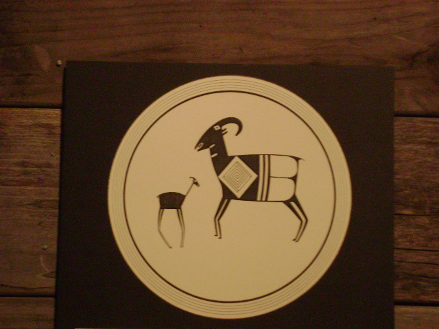 |
| Example of Mimbres Pottery Designs |
The drive
from Silver City back to I 10 was nothing outstanding. We did cross the
continental divide at 6355 ft along the way. We had crossed it somewhere on our
drive on NM 15 but here we were again. This was a very desolate country –
desert with just a few plants and bare mountains off in the distance. When we reached Lordsburg Jane learned how to
find a post office on the GPS so we could mail Daniel’s post card from New
Mexico. We
found the Ghost Town of Shakespeare but it did not look like it was worth the
money – we have seen better ghost towns along many highways we have
traveled. We headed west on I 10 and
before long we were in Arizona.

There was a
strong wind and signs warned of dust storms. There were flashing lights when
the visibility was obscured. We only saw the lights flashing once but did be
sure our windows were closed and drove carefully. You would see a cyclone like spiral of dust
and it just traveled across the landscape sometimes towards you and sometimes
not.
We were
watching for the exit to Fort Bowie National Monument. This
fort was built after the Butterfield Stage days as a protection for the area
from Indians. There were many battles with the Apaches in this area. Before the Fort was built near Apache Pass
and Apache Springs the Butterfield Stage passed this way. Apache Pass was the one good route through
these mountains and with water here too it was a perfect location for travelers.
 |
| Approaching Apache Pass |
We found our
road and turned south passing by orchards of walnut or pecan trees and huge
vineyards. They must be using irrigation as it is VERY dry. The road was paved for about 20 miles and then
turned to a well graded dirt road. We knew there was a trailhead and a hike
required to the Fort. Turned out it was 1.5 miles to the fort – not all
climbing but it would have been in full sun and the altitude was 5,327 ft.
We stopped at the trailhead and talked with
some folks who were just getting back – they said it was not too bad. Another man was waiting for his wife to come
down from the Fort. He had driven her up
on the park access road and she was walking down. Three miles in this heat did not seem like the wise thing for us to attempt.

We ate lunch and retraced our
way back down the road a way and saw the access road that was marked poorly as
the handicap access only…well for today I was going to be handicapped! We drove about 5 miles up another dirt road
past a religious commune of some sort and into the park service garages and
staff homes area. A trail (I suppose the
handicap access) was about 500 feet uphill and included 8-10 steep concrete
steps. Much better than the 3 mile hike
up and down from the trailhead but if someone were severely handicapped they
could certainly not make it up that trail and stairs.


It was hot
and the wind was blowing fiercely – maybe 30 mph – I had on my sun hat and had
to hold it on as the chin strap did no good…. There was a nice visitor center
and quite a few remains of Fort Bowie.
We had a good visit with the ranger on duty as well as several other
hikers and a couple who came in on horseback.
By talking with them we discovered where the Butterfield Trail crossed
over the current dirt road. Jane got our
passport stamp probably the most
difficult one we have ever obtained!
After a nice
visit at this most unusual spot we headed back to the Sprinter and retraced our
route to the trailhead. By following this route on to where it joins another AZ
road we would pass right by where the Butterfield crossed….and we found it –
clearly marked and got some great photos.
We have passed by many places we were fairly certain were close to the
actual trail but this part was clearly marked for quite a way by 4x4 marking
posts. It was tough just walking this route let along riding it on a stage…
 |
| Actual Butterfield Trail at Apache Pass |
We continued
on about 15 miles to a paved road and then drove north to Willcox. Connecting back to I I0 we found it was one
hour earlier than we thought – we had passed into another time zone. Later we found AZ is on California time in
the summer and NM time in the winter.. does not make much sense to me but hey
when in AZ do as they do!
We continued
west until we came to Benson and decided to stay for the night. Ben had been
fighting the wind (25mph we found out) most of the day and was tired. We saw a sign for a KOA and started towards
it when we saw the Butterfield RV Resort – well we had to try it. Really nice park one of the ones the “snow
birds” stay in during the winter. It has
a pool, hot tub, workout room, library, observatory, WIFI, cable TV, nice
bathrooms and a huge laundry room. All
for less than we have been paying for the recent KOA’s – we stayed and enjoyed
some of the amenities.


There was a nice Safeway Grocery a block away so we
caught up on the shopping and bought some fried chicken and salads from the
deli for supper. Since this is not THE
season there are few people here.
In the late
afternoon the temperature was 95 but with the wind blowing it did not seem so
warm. Ben sat in the sun for a while and said he felt like he had a wind
massage! It is now 8:30 and with the sun
down the temperature is down to 80 and will probably be 70 for sleeping. So far it has not been uncomfortable at all –
we have promised ourselves we will stay in a motel if it is too warm for
sleeping in Southern California.


No comments:
Post a Comment